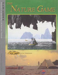
Welcome to our Nature Guide
When all the large islands were connected into one land mass it was a subcontinent called the "Sunda Shelf''. Look closely at the
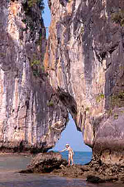
channels between the islands, and you can see that many ridge lines were actually connected before the elements eroded them apart. Tidal currents running down the Bay hit North Panak head-on. Their power ate away two galleries of sea level, creating a nape that is both high and wide. The 1 top level was created first, allowing the exterior stalactites to form. It all makes for a great paddle in the shade.
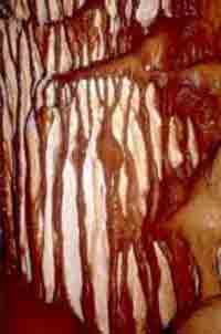
The top photo shows exterior stalactites created by percolation, and a long, deep Hong created by a collapsed semi-tidal cavern. The cavern remains at the back of the 2K "overnighter" Hong, relentlessly percolating away. The bottom cave sits in mountains at the top of the Peninsula. It's easy to see how this river cave runs along a fault line, and how water seeping down the fault formed these stalactites.
The process that dissolves particles in the water that flows down through the island is called "Percolation" - in the same way as percolating water goes through coffee grounds. Clear water picks up the coffee molecules as it runs through the grounds, and drips brown-colored coffee into the pot.
|
||||||||||||||||||
 Science
bored many of us in school-it wasn't taught properly. Forget
all that!
Science
bored many of us in school-it wasn't taught properly. Forget
all that! 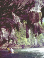
 Limestone is brittle, but it is also easily dissolved by rainwater. The fine silt that runs from the islands is called "alluvium." Because it is colored red by high iron content, this alluvium forms the red mud banks so common around Thailand's coastlines.It is quite likely that when sea levels were lower, Phang Nga Bay was a giant valley peppered with limestone pinnacles. As the alluvium ran from the limestone ridges, it created the jagged structures called "karst". The alluvium flowed into the deepest parts of the valley. Ever since the tides submerged the valley, tidal friction regulates the level of the mud banks, keeping them just below the lowest low tide.
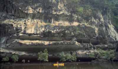
 With its origins in coral, limestone is brittle.You see countless cracks or faults in the rock created by pressure.When large faults slip, the limestone breaks off in blocks, often big enough to become these islands.Imagine huge limestone blocks floating on the Earth's crust
like a cube of ice
floating in a glass of water. When continental plates drift, the limestone spins and bobs up and down just like ice does when you put your finger on the cubes. These cracks collect oxide before the rock rotates again, taking the iron ore high above sea level. Percolation enlarges the cracks, depositing particulates "downstream" as flowstone. Caves form along these cracks when water percolates downhill, filling the cavern with stalactites. Some cave roofs have holes leading to either sunlight or another cave, the earliest point of Hong creation. Eventually, the cavern will collapse, one way of forming a
With its origins in coral, limestone is brittle.You see countless cracks or faults in the rock created by pressure.When large faults slip, the limestone breaks off in blocks, often big enough to become these islands.Imagine huge limestone blocks floating on the Earth's crust
like a cube of ice
floating in a glass of water. When continental plates drift, the limestone spins and bobs up and down just like ice does when you put your finger on the cubes. These cracks collect oxide before the rock rotates again, taking the iron ore high above sea level. Percolation enlarges the cracks, depositing particulates "downstream" as flowstone. Caves form along these cracks when water percolates downhill, filling the cavern with stalactites. Some cave roofs have holes leading to either sunlight or another cave, the earliest point of Hong creation. Eventually, the cavern will collapse, one way of forming a 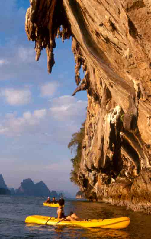 Water is today's theme. You are obviously surrounded by sea water, but it's rain
water that creates the bizarre karst that attracts people to Phang Nga Bay. Even in thedry season, rainwater drips down inside the cave in a never-ending process that eatsaway the islands.Heavy rainfall creates karst, so these grotesque shapes are usually found in the
Tropics. The combination of raised reef limestone in a tropical monsoon region
creates this great karst region.
Water is today's theme. You are obviously surrounded by sea water, but it's rain
water that creates the bizarre karst that attracts people to Phang Nga Bay. Even in thedry season, rainwater drips down inside the cave in a never-ending process that eatsaway the islands.Heavy rainfall creates karst, so these grotesque shapes are usually found in the
Tropics. The combination of raised reef limestone in a tropical monsoon region
creates this great karst region.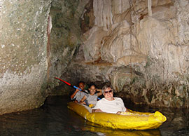
Informations
- Lagoon, Hongs, Caves
- Animals of Phang Nga Bay
- Birds of Phang Nga Bay
- Nature Guide
- Flowstone
- Year-Round Season
